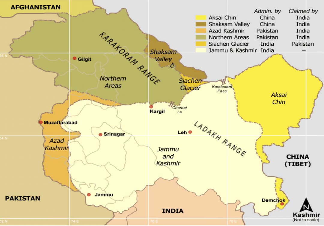
Geography in Jammu and Kashmir
Happy Travellers
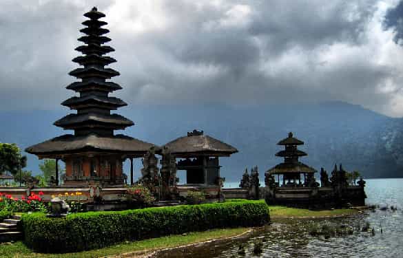
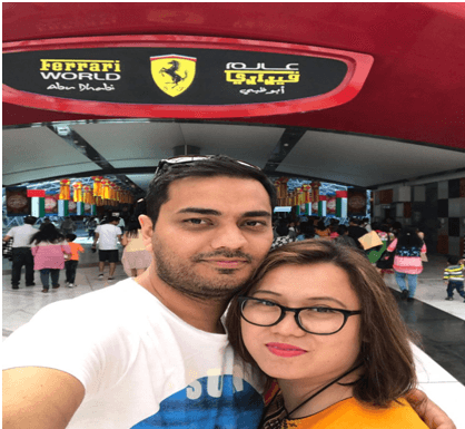
We had the pleasure of visiting Bali
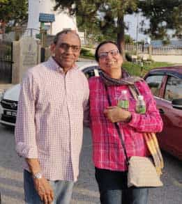
Ms. Beena Shah & Mr. Pravin Shah
We had the pleasure of visiting Bali on a tour organized by Flamingo Transworld Pvt Ltd, and I would like to express my heartfelt appreciation for the truly memorable experience. The entire tour was extremely well organized from beginning to end, ensuring a smooth and enjoyable journey without any inconvenience. Every aspect of the trip was thoughtfully planned, which made our overall experience absolutely excellent.
The tour manager, Sangitaben, was truly the best of the best. professionalism, dedication, and friendly approach made us feel comfortable and well cared for throughout the tour. They were always available to assist, guide, and ensure that every traveler had a pleasant experience. The food and accommodation arrangements were also outstanding. We were provided with excellent meals and comfortable stays that exceeded our expectations, adding great value to the overall trip.
The sightseeing schedule was very well organized, allowing us to explore beautiful locations at a relaxed pace without feeling rushed. Each destination was carefully selected, and the arrangements ensured that we could fully enjoy the natural beauty and cultural richness of Bali. Safety was given topmost priority throughout the tour, which gave us complete peace of mind while traveling.
One of the highlights of the trip was the wonderful celebration of Valentine’s Day, which was organized in a very special and memorable way. The thoughtful arrangements and joyful atmosphere made the occasion truly delightful for everyone.
Overall, this tour was an exceptional experience filled with comfort, enjoyment, and unforgettable memories. I would love to travel again in the future with Flamingo and experience more such wonderful journeys. I highly recommend this tour company to my friends and family for their excellent service, careful planning, and commitment to providing an outstanding travel experience.
Beena and I (Pravin Shah) would personally like to acknowledge Sangitaben’s efforts and her kindness. We sincerely wish her continued success and all the very best in the future. We also hope her dedication and hard work receive the recognition she truly deserves from senior management.
THANK YOU!!!
Highly Recommended Tour Experience with Flamingo
Mr. Neel Patel
Me and my husband recently traveled to Paris and Switzerland with Flamingo Travel and had a truly great experience. The trip was very well-organized, hotels were comfortable, and the sightseeing itinerary covered all the highlights. Everything went smoothly, and we came back with beautiful memories.
A special thanks to Mrs. Unnati Jariwala, our tour manager, for her professional guidance and friendly support throughout the journey.
Overall, it was a fantastic experience. We would highly recommend Flamingo to anyone looking for a comfortable, enjoyable, and well-managed tour!

Highlights of South Asia journey
Ms. Bharti Patel
I like to know History and Culture of different country.I like Thai culture,saw

31st Jan Southeast Asia Tour
Mr. Yayati Patel
Singapore Malaysia Tour-21st Dec to 31st Dec
Mr. Chetan Gandhi
Hotel Food And Staff Services Was Very Nice
Mr. Shambahadur Thakur

We Love Partnering With You On Our Travels!
Priyanka Desai

We Have Enjoyed Our Dubai Trip!
Mr. Rahul Bhasin
We Couldn’t Dream Of A Better Vacation Than This!
Mr. Neeraj Amin

Thanks Flamingo Team To Make Our Dream Come True
Mr. & Mrs. Nehal Gandhi

Trending travel articles

Summary: Looking for a budget-friendly Bali trip in 2026? This blog shows how you can enjoy a relaxing 5-day Bali Trip under ?30000/- by choosing smart stays, simple food and the right places. Perfect for first-time Indian travellers looking for a budget-friendly Bali holiday. We all have seen tons of pics of temples, Bali Swing, […]

Summary: Your dream of exploring Japan is possible, even with a strict budget! This blog shares how Japan tour packages from India under ?3 lakh are possible. It covers real costs, budget tips, the best time to visit, and much more. It helps you understand how to save money and still enjoy a great Japan […]

Summary: A trip to Singapore can fit your budget with the right plan. This blog explains how Singapore tour packages from India under ?1 lakh work, what costs to expect, and how to save money. It helps you understand the best places to visit in Singapore in 2026 so you can enjoy this island country […]

Summary: Indian restaurants in Hanoi are more than just places to eat. They serve Indian food with a Vietnamese welcome. Whether you are a vegetarian, prefer halal food, or just miss home-style dal, these restaurants have it all. Every meal is served with care and a friendly smile, making you feel right at home in […]

Summary: Macau Travel – Macau is a city that never slows down—filled with luxury hotels, thrilling attractions, endless nightlife, and unforgettable energy. From staying at The Venetian to breathtaking Macau Tower views and vibrant casinos, Muskan Golecha’s experience captures the true spirit of a city that you don’t just visit, you live! Macau is one […]

Summary: If you want a calm, scenic, and well-paced trip, this 10 days itinerary for Switzerland is made for you. It suits families, honeymooners, seniors, and solo travellers. This plan combines top attractions with relaxed, easy travel days. It also keeps Indian comfort in mind. Read on to get the full day-by-day plan, smart tips, […]

Summary: Switzerland in winter 2026 is pure magic, snow-dusted Alps, glittering Christmas markets, and cozy wooden chalets bring fairytales to life. Whether you are sipping hot chocolate by the beautiful Swiss lakes or exploring the festive streets of cities, it feels like a movie. Perfect for Indian travellers, families, and honeymooners. This blog helps you […]

Summary: Experience the magic of Christmas in Dubai 2025, where the city sparkles with lights, music, and festive cheer. From grand events to lively markets and fireworks, every corner feels joyful. Enjoy delicious food, family fun, and exciting shopping deals during the Dubai festive season. Plan your trip easily with Dubai Tour Packages and make […]

Summary: Experience the magic of a trip to Bhutan in December 2025, with clear skies, vibrant festivals, fewer crowds, and stunning mountain views. This blog guides you through weather updates, travel tips, places to visit, and must-try experiences for your perfect Bhutan holiday. Plan your relaxing, crowd-free visit to Bhutan and experience the authentic charm […]

Summary: Trip To Vietnam Under ?60000 – Dreaming of travelling to Vietnam without stretching your wallet? This blog shares how to plan your trip to Vietnam under ?60,000. It shares everything, including flights, hotels, meals, and activities. Discover must-visit cities, real cost breakdown, and much more to make your Vietnam tour package memorable yet budget-friendly. […]